Tennessee Landforms -- arches and natural bridges| WGS84 |
| 36.215370 | -84.131200 |
| 36° 12.922'N | 84° 7.872'W |
| 36° 12' 55.3"N | 84° 7' 52.3"W |
| 16S 757886E 4011653N |
| convert to NAD27 |
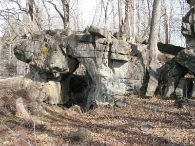
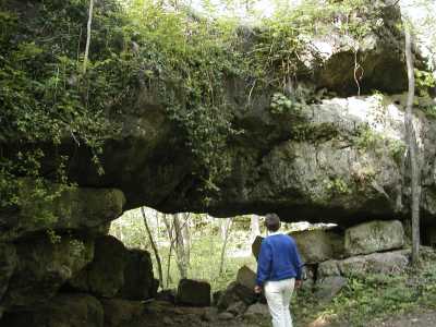
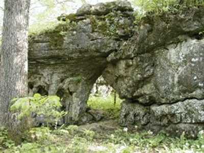
Savage Garden Arches (4+) 15x10
Waypoint: ANA004 36.215370,-84.131200
County: Anderson landforms of Anderson county
Locale: private
NABSQNO 16S-757886-4011653
popup list of
nearby landforms (mileage, bearing)
MAPS
Select one of the following maps to display this waypoint (WGS84).
GPS
Remarks:
References: JNAD:TENN-45,53,57
Here are some of the arches at Savage Gardens -- a limestone labyrinth.
This is on private property but open to the public at designated times.
It is a beautiful wildflower walk in April.
Tennessee landforms
home
arches
waterfalls
rocks
peaks
balds
sinks
lakes
regions
county
GSMNP landforms (TN/NC)
BSF landforms (TN/KY)
or nearby
lookout towers
Chuck Sutherland's www.tnlandforms.com the future (2024)
 ©
Tom Dunigan
©
Tom Dunigan