Tennessee Landforms -- arches and natural bridges| WGS84 |
| 36.217400 | -84.127540 |
| 36° 13.044'N | 84° 7.652'W |
| 36° 13' 2.6"N | 84° 7' 39.1"W |
| 16S 758208E 4011888N |
| convert to NAD27 |
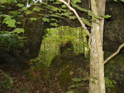
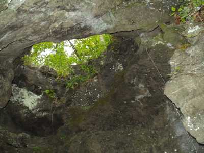
Coal Creek Arches 4x5
Waypoint: ANA001 36.217400,-84.127540
County: Anderson landforms of Anderson county
Locale: private
NABSQNO 16S-758208-4011888
popup list of
nearby landforms (mileage, bearing)
MAPS
Select one of the following maps to display this waypoint (WGS84).
GPS
Remarks:
Arches just above the road, part of the Savage Gardens/Lovely Bluff geology.
Tennessee landforms
home
arches
waterfalls
rocks
peaks
balds
sinks
lakes
regions
county
GSMNP landforms (TN/NC)
BSF landforms (TN/KY)
or nearby
lookout towers
Chuck Sutherland's www.tnlandforms.com the future (2024)
 ©
Tom Dunigan
©
Tom Dunigan