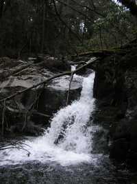
 20' falls 200' climb above Ramsay Cascade
| WGS84 | |
| 35.706200 | -83.295300 |
| 35° 42.372'N | 83° 17.718'W |
| 35° 42' 22.3"N | 83° 17' 43.1"W |
| 17S 292348E 3953791N | |
| convert to NAD27 | |
MAPS
Select one of the following maps to display this waypoint (WGS84).
GPS
Remarks:
A number of cascades are located off-trail above Ramsay Cascade.
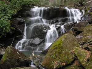
20' falls 200' climb above Ramsay Cascade
Pictured below are portions of 100' cascade (the waypoint)
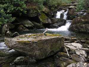
Above this upper cascade is Drinkwater Pool and coffin rock
(35.7056 -83.2928) described by Harvey Broome.
In Out Under the Sky of the Great Smokies Broome writes,
"I spotted Drinkwater [Pool] from far downstream
by the casket-shaped rock on its shelving rim." (pg 162).
See photos below.
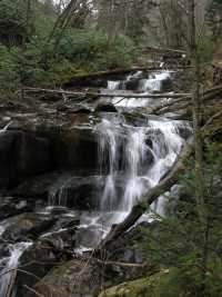
Further upstream is another series of cascades
(35.7049 -83.29044).
See photo below
See Dutch Roth 1934 black & white
 AT shelters
BSF landforms (TN/KY)
AT shelters
BSF landforms (TN/KY)