| WGS84 | |
| 35.643000 | -83.482150 |
| 35° 38.58'N | 83° 28.929'W |
| 35° 38' 34.8"N | 83° 28' 55.7"W |
| 17S 275263E 3947191N | |
| convert to NAD27 | |
MAPS
Select one of the following maps to display this waypoint (WGS84).
GPS
Remarks:
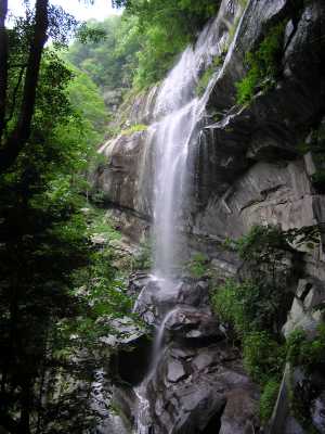
A manway leads to this wet-weather falls
Also see Dutch Roth's black&white and winter
 AT shelters
BSF landforms (TN/KY)
AT shelters
BSF landforms (TN/KY)