Great Smoky Mountains National Park Landforms| WGS84 |
| 35.669300 | -83.662200 |
| 35° 40.158'N | 83° 39.732'W |
| 35° 40' 9.5"N | 83° 39' 43.9"W |
| 17S 259037E 3950536N |
| convert to NAD27 |
The Sinks 12'
Waypoint: SVF009 35.669300,-83.662200
Locale: Sevier
popup list of
nearby landforms/campsites (mileage, bearing)
MAPS
Select one of the following maps to display this waypoint (WGS84).
GPS
Remarks:
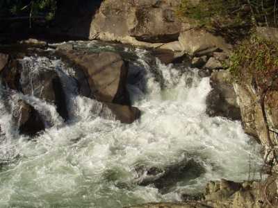
meander cut through geology
GSMNP landforms and campsites
and
trails (TN/NC)
 AT shelters
BSF landforms (TN/KY)
AT shelters
BSF landforms (TN/KY)
Tennessee landforms
home
arches
waterfalls
rocks
peaks
balds
sinkholes
lakes
regions
 ©
Tom Dunigan
©
Tom Dunigan