Great Smoky Mountains National Park Landforms| WGS84 |
| 35.708610 | -83.300830 |
| 35° 42.517'N | 83° 18.05'W |
| 35° 42' 31"N | 83° 18' 3"W |
| 17S 291854E 3954070N |
| convert to NAD27 |
Ramsay Cascades 65'
Waypoint: SVF008 35.708610,-83.300830
Locale: Sevier
popup list of
nearby landforms/campsites (mileage, bearing)
MAPS
Select one of the following maps to display this waypoint (WGS84).
GPS
Remarks:
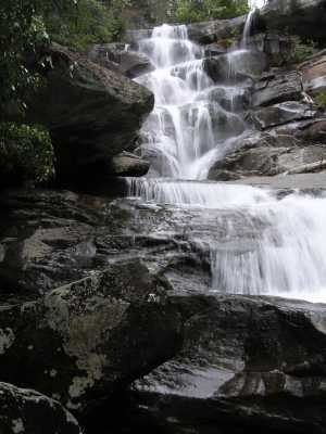
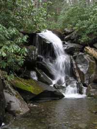 20' cascade 200' downstream (35.708167,-83.304088)
GSMNP landforms and campsites
and
trails (TN/NC)
 AT shelters
BSF landforms (TN/KY)
AT shelters
BSF landforms (TN/KY)
Tennessee landforms
home
arches
waterfalls
rocks
peaks
balds
sinkholes
lakes
regions
 ©
Tom Dunigan
©
Tom Dunigan