| WGS84 | |
| 35.636600 | -83.437920 |
| 35° 38.196'N | 83° 26.275'W |
| 35° 38' 11.8"N | 83° 26' 16.5"W |
| 17S 279251E 3946381N | |
| convert to NAD27 | |
MAPS
Select one of the following maps to display this waypoint (WGS84).
GPS
Remarks:
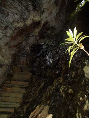
The Alum Cave trail passes through this natural bridge.
Dutch Roth's photograph January, 1936
 AT shelters
BSF landforms (TN/KY)
AT shelters
BSF landforms (TN/KY)