Great Smoky Mountains National Park Campsites| WGS84 |
| 35.561782 | -83.766522 |
| 35° 33.707'N | 83° 45.991'W |
| 35° 33' 42.4"N | 83° 45' 59.5"W |
| 17S 249256E 3938868N |
| convert to NAD27 |
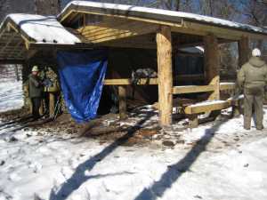
SHELTER RUSSELL FIELD 
Waypoint: SHRSFL 35.561782,-83.766522
Locale: AT AT
Elevation: 4360'
reservation and fee required
GSMNP camping info permits, fees, reservations etc.
popup list of
nearby landforms/campsites (mileage, bearing)
MAPS
Select one of the following maps to display this waypoint (WGS84).
GPS
Remarks:
Reservation required: max 14 people, 14 horses
See additional AT shelter info.
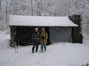
 after September,2010 makeover
GSMNP landforms and campsites
and
trails (TN/NC)
 AT shelters
BSF landforms (TN/KY)
AT shelters
BSF landforms (TN/KY)
Tennessee landforms
home
arches
waterfalls
rocks
peaks
balds
sinkholes
lakes
regions
 ©
Tom Dunigan
©
Tom Dunigan