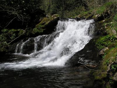
 lower falls 25' (waypoint)
| WGS84 | |
| 35.611300 | -83.261200 |
| 35° 36.678'N | 83° 15.672'W |
| 35° 36' 40.7"N | 83° 15' 40.3"W |
| 17S 295191E 3943191N | |
| convert to NAD27 | |
MAPS
Select one of the following maps to display this waypoint (WGS84).
GPS
Remarks:
Reference: Dana Koogler
lower falls 25' (waypoint)
 upper falls 12' at 35.6136 -83.2678, and lots
of cascades between these two falls.
upper falls 12' at 35.6136 -83.2678, and lots
of cascades between these two falls.
 AT shelters
BSF landforms (TN/KY)
AT shelters
BSF landforms (TN/KY)