Great Smoky Mountains National Park Landforms| WGS84 |
| 35.719310 | -83.133430 |
| 35° 43.159'N | 83° 8.006'W |
| 35° 43' 9.5"N | 83° 8' 0.4"W |
| 17S 307026E 3954915N |
| convert to NAD27 |
Upper W. Mouse Cr 35'
Waypoint: NCF016 35.719310,-83.133430
Locale: NC
popup list of
nearby landforms/campsites (mileage, bearing)
MAPS
Select one of the following maps to display this waypoint (WGS84).
GPS
Remarks:
Reference: USGS topo
off-trail
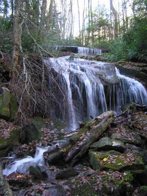
nearby is bigger falls
GSMNP landforms and campsites
and
trails (TN/NC)
 AT shelters
BSF landforms (TN/KY)
AT shelters
BSF landforms (TN/KY)
Tennessee landforms
home
arches
waterfalls
rocks
peaks
balds
sinkholes
lakes
regions
 ©
Tom Dunigan
©
Tom Dunigan