Great Smoky Mountains National Park Landforms| WGS84 |
| 35.492460 | -83.169610 |
| 35° 29.548'N | 83° 10.177'W |
| 35° 29' 32.9"N | 83° 10' 10.6"W |
| 17S 303198E 3929821N |
| convert to NAD27 |
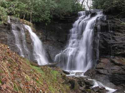
Soco Falls 50'
Waypoint: NCF012 35.492460,-83.169610
Locale: Cherokee
popup list of
nearby landforms/campsites (mileage, bearing)
MAPS
Select one of the following maps to display this waypoint (WGS84).
GPS
Remarks:
GSMNP landforms and campsites
and
trails (TN/NC)
 AT shelters
BSF landforms (TN/KY)
AT shelters
BSF landforms (TN/KY)
Tennessee landforms
home
arches
waterfalls
rocks
peaks
balds
sinkholes
lakes
regions
 ©
Tom Dunigan
©
Tom Dunigan