Great Smoky Mountains National Park Landforms| WGS84 |
| 35.587220 | -83.310810 |
| 35° 35.233'N | 83° 18.649'W |
| 35° 35' 14"N | 83° 18' 38.9"W |
| 17S 290634E 3940624N |
| convert to NAD27 |
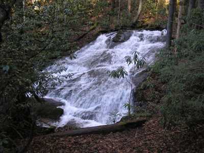
Chasteen Creek Cascade 30'
Waypoint: NCF001 35.587220,-83.310810
Locale: NC
popup list of
nearby landforms/campsites (mileage, bearing)
MAPS
Select one of the following maps to display this waypoint (WGS84).
GPS
Remarks:
GSMNP landforms and campsites
and
trails (TN/NC)
 AT shelters
BSF landforms (TN/KY)
AT shelters
BSF landforms (TN/KY)
Tennessee landforms
home
arches
waterfalls
rocks
peaks
balds
sinkholes
lakes
regions
 ©
Tom Dunigan
©
Tom Dunigan