Great Smoky Mountains National Park Landforms| WGS84 |
| 35.651900 | -83.713000 |
| 35° 39.114'N | 83° 42.78'W |
| 35° 39' 6.8"N | 83° 42' 46.8"W |
| 17S 254384E 3948731N |
| convert to NAD27 |
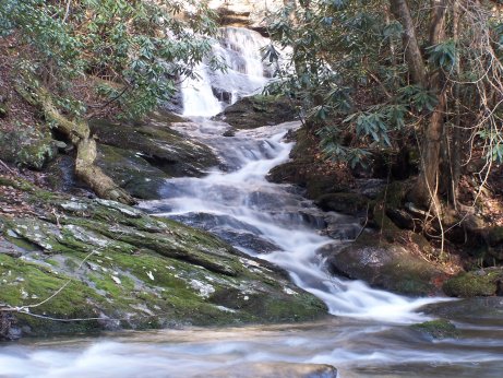
Meadow Branch Cascade 40'
Waypoint: BTF019 35.651900,-83.713000
Locale: Blount
popup list of
nearby landforms/campsites (mileage, bearing)
MAPS
Select one of the following maps to display this waypoint (WGS84).
GPS
Remarks:
Reference & photo: Robert Robbins
GSMNP landforms and campsites
and
trails (TN/NC)
 AT shelters
BSF landforms (TN/KY)
AT shelters
BSF landforms (TN/KY)
Tennessee landforms
home
arches
waterfalls
rocks
peaks
balds
sinkholes
lakes
regions
 ©
Tom Dunigan
©
Tom Dunigan