Great Smoky Mountains National Park Landforms| WGS84 |
| 35.674520 | -83.692550 |
| 35° 40.471'N | 83° 41.553'W |
| 35° 40' 28.3"N | 83° 41' 33.2"W |
| 17S 256305E 3951190N |
| convert to NAD27 |
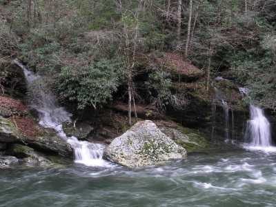
Cane Creek Twin Falls 8'
Waypoint: BTF012 35.674520,-83.692550
Locale: Blount
popup list of
nearby landforms/campsites (mileage, bearing)
MAPS
Select one of the following maps to display this waypoint (WGS84).
GPS
Remarks:
GSMNP landforms and campsites
and
trails (TN/NC)
 AT shelters
BSF landforms (TN/KY)
AT shelters
BSF landforms (TN/KY)
Tennessee landforms
home
arches
waterfalls
rocks
peaks
balds
sinkholes
lakes
regions
 ©
Tom Dunigan
©
Tom Dunigan