| WGS84 | |
| 35.633000 | -83.679700 |
| 35° 37.98'N | 83° 40.782'W |
| 35° 37' 58.8"N | 83° 40' 46.9"W |
| 17S 257342E 3946551N | |
| convert to NAD27 | |
MAPS
Select one of the following maps to display this waypoint (WGS84).
GPS
Remarks:
off-trail from Spruce Flats manway
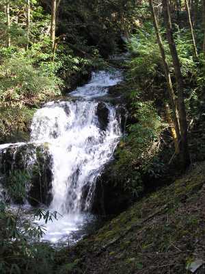
 20' wet-weather falls upstream
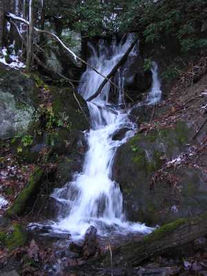
 AT shelters
BSF landforms (TN/KY)
AT shelters
BSF landforms (TN/KY)