| WGS84 | |
| 35.562300 | -83.800500 |
| 35° 33.738'N | 83° 48.03'W |
| 35° 33' 44.3"N | 83° 48' 1.8"W |
| 17S 246177E 3939012N | |
| convert to NAD27 | |
MAPS
Select one of the following maps to display this waypoint (WGS84).
GPS
Remarks:
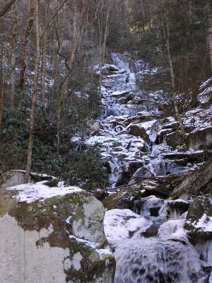
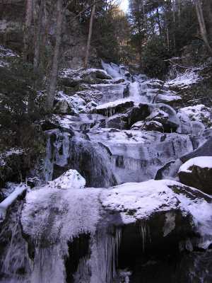
Reference: Wise, description
long cascade, off-trail. (old wagon road, see 1931 map above)
There is a small arch at the top of the falls.
 AT shelters
BSF landforms (TN/KY)
AT shelters
BSF landforms (TN/KY)