| this button will popup a window from which you can save the track as a file.gpx for uploading to your GPS. |
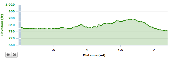
The City has funding for extending the Melton Lake Greenway from the southern end on to Haw Ridge Park and west to the Haw Ridge kiosk/parking area. This should add about 2.2 miles of 10'-wide asphalt greenway to the Melton Lake Greenway. Along the lake there will be concrete and a boardwalk over the "wetlands". The west-end parking area will be paved as part of the project. Construction started in June, 2011 and completed April, 2012.
- phase 4 map with Haw Ridge trails
- phases of Melton Lake Greenway
- City phase IV info


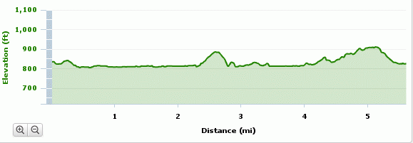
Melton Lake Greenway with phase4 extends 5.6 miles, 300' cumulative climb.
★ Google map of mountain bike trails in
Haw Ridge Park
and Melton Lake Greenway. 2/29/16
No motorized vehicles. No horses.
GPS files: trails hrtrails.gpx,
numbered posts hrposts.gpx
and map posts hrmapposts.gpx
Δ highest point in Haw Ridge
post 14
(1157')
Δ highest point in Oak Ridge,
Melton Hill (1356'), ORNL reservation
Other Google maps arches falls GSMNP BSF towers AT shelters Oak Ridge greenways
 Tennessee landforms
GSMNP landforms
BSF landforms
AT shelters
visits since 1/1/10,
Tom Dunigan TNlandforms.US