Tennessee Landforms Google map
right click to add draggable markers iPhone map
marker:
Enter street,city,state or zip code or lat,-lon (dd.ddd)
(for lat/lon or UTM or NAD27 use this)
Distance buttons:
click on map to make a track (right-click to add draggable markers)
this button will popup a window from which you can save the track as a
file.gpx for uploading to your GPS.
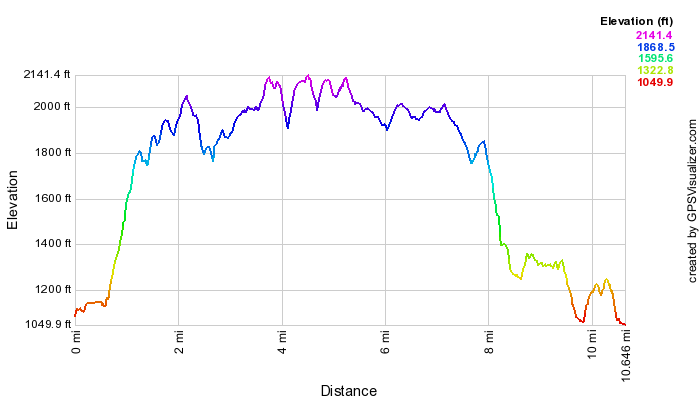
Maps shows a GPS track file of
Cumberland Trail from Tank Springs to Bruce Gap
trailhead (11.7 miles) --
camp/shelter (mile 2.8), Eagle Bluff (mile 6.1), Devils Race Track (mile 8.5).
Cumulative climb 2880' (or 2850' west to east),
max gradient 38%.
Also see east-to-west elevation profile
(30m DEM).
(Comparison of GPS and 10m DEM elevation
data).
Also see more
track data and
and Trimble
track report
and
localhikes.com description
GPS tracks show distance as 10.8 miles.
The GPS trip odometer reported 11.3 miles,
and the GPS track length was 10.7652 miles.