 NOAA weather near waypoint
or
wunderground
NOAA weather near waypoint
or
wunderground
| WGS84 | |
| 36.577938 | -84.694505 |
| 36° 34.676'N | 84° 41.67'W |
| 36° 34' 40.6"N | 84° 41' 40.2"W |
| 16S 706278E 4050527N | |
| convert to NAD27 | |
MAPS
Select one of the following maps to display this waypoint (WGS84).
NOAA weather near waypoint
or
wunderground
GPS
Remarks:
 One of the falls listed in the
1970's BSF survey, off-trail
One of the falls listed in the
1970's BSF survey, off-trail
Nearby, Duane Ridenour reports another survey falls (1114)
at
36.57639, -84.69172
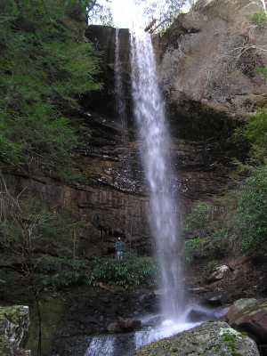
 50', East Anderson Falls
and near a small arch, another falls at
36.5763167, -84.6908
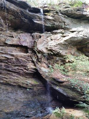
 29', Alta Falls
and downstream from Anderson Falls at
36.578275, -84.694029
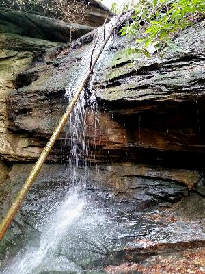
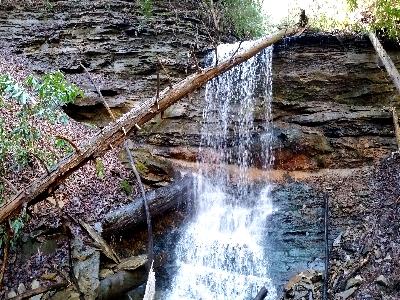 14', Rosebay Falls