 NOAA weather near waypoint
or
wunderground
NOAA weather near waypoint
or
wunderground
| WGS84 | |
| 36.495280 | -84.651110 |
| 36° 29.717'N | 84° 39.067'W |
| 36° 29' 43"N | 84° 39' 4"W |
| 16S 710386E 4041450N | |
| convert to NAD27 | |
MAPS
Select one of the following maps to display this waypoint (WGS84).
NOAA weather near waypoint
or
wunderground
GPS
Remarks:
This is just a rapids in the Big South Fork River -- more significant if you are in a canoe.
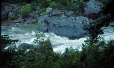 Photo by Gregory Plumb, Author of
Waterfalls of Tennessee
Photo by Gregory Plumb, Author of
Waterfalls of Tennessee