NOAA weather near waypoint
or
wunderground
NOAA weather near waypoint
or
wunderground
| WGS84 | |
| 36.564640 | -84.650700 |
| 36° 33.878'N | 84° 39.042'W |
| 36° 33' 52.7"N | 84° 39' 2.5"W |
| 16S 710234E 4049147N | |
| convert to NAD27 | |
MAPS
Select one of the following maps to display this waypoint (WGS84).
NOAA weather near waypoint
or
wunderground
GPS
Remarks:
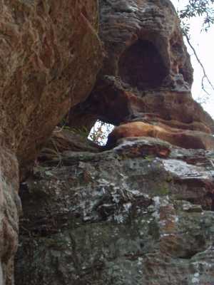
This arch is high on the cliff wall. off-trail