 NOAA weather near waypoint
or
wunderground
NOAA weather near waypoint
or
wunderground
| WGS84 | |
| 36.334970 | -84.742255 |
| 36° 20.098'N | 84° 44.535'W |
| 36° 20' 5.9"N | 84° 44' 32.1"W |
| 16S 702637E 4023469N | |
| convert to NAD27 | |
MAPS
Select one of the following maps to display this waypoint (WGS84).
NOAA weather near waypoint
or
wunderground
GPS
Remarks:
References: JNAD:TENN-6, WAD:44.16, JNAD 14, Leslie Ellis/John Burns
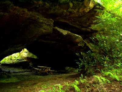
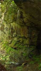
Reachable by land or by canoe. Trail and stairs lead to this large bridge with picnic tables and a small waterfall nearby. A trail goes 200' to the North to the Clear Fork (36.3356 -84.74221 ) 'bout 4 miles downstream from Peters Bridge.