 NOAA weather near waypoint
or
wunderground
NOAA weather near waypoint
or
wunderground
| WGS84 | |
| 36.769243 | -84.538119 |
| 36° 46.155'N | 84° 32.287'W |
| 36° 46' 9.3"N | 84° 32' 17.2"W |
| 16S 719728E 4072101N | |
| convert to NAD27 | |
MAPS
Select one of the following maps to display this waypoint (WGS84).
NOAA weather near waypoint
or
wunderground
GPS
Remarks:
Reference and photos: Chad Harrold, wet-weather falls
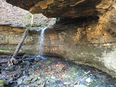 lower falls
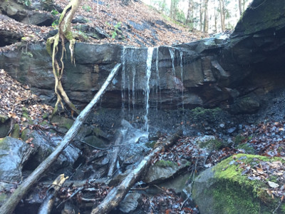 Upper Falls, a little up stream at
36.768825,-84.537964
Upper Falls, a little up stream at
36.768825,-84.537964