 NOAA weather near waypoint
or
wunderground
NOAA weather near waypoint
or
wunderground
| WGS84 | |
| 36.642384 | -84.631615 |
| 36° 38.543'N | 84° 37.897'W |
| 36° 38' 32.6"N | 84° 37' 53.8"W |
| 16S 711730E 4057815N | |
| convert to NAD27 | |
MAPS
Select one of the following maps to display this waypoint (WGS84).
NOAA weather near waypoint
or
wunderground
GPS
Remarks:
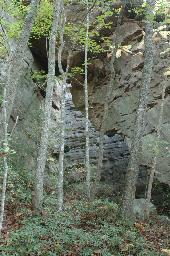
Reference: team Fife. Photo courtesy Bill Patrick.
Gary Stephens photo