Appalachian Trail Shelters| WGS84 |
| 34.94594 | -83.58828 |
| 34° 56.756'N | 83° 35.297'W |
| 34° 56' 45.4"N | 83° 35' 17.8"W |
| 17S 263632E 3870107N |
| convert to NAD27 |
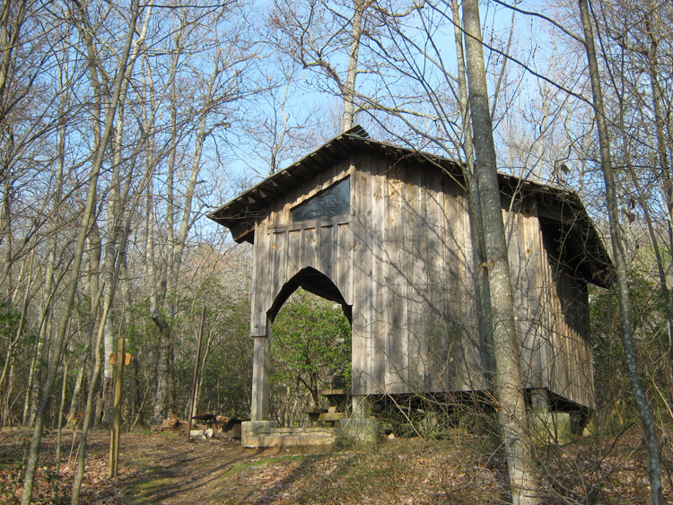
Plumorchard Gap Shelter 
Waypoint: Plumorchar 34.94594,-83.58828
County/State: Towns GA
Elevation: 3050' or USGS elevation
73.9 miles from Springer and 2123.5 miles to Katahdin
next shelter south ↓ 8.1 miles. next shelter north ↑ 7.3 miles. all shelters
popup list of
nearby shelters (mileage, bearing) (as the crow flies)
 NOAA weather near shelter
or
wunderground
NOAA weather near shelter
or
wunderground
MAPS
Select one of the following maps to display this waypoint (WGS84).

GPS
These maps, coordinates, and waypoint files are based on recent (2009)
Appalachian Trail
waypoints.
You can often find more information on a particular
shelter by visiting the AT
partners that maintains that section of trail.
For trail mileages between shelters go back to our
list of shelters.
AppalachianTrail.org has
the latest trail conditions, maps, and trail guides.
Additional information:
Notes: Shelter has water; a second spring is located 0.1 mi from AT on side trail to W
USGS quad: HIGHTOWER BALD
Δ elevation profile to next shelter north, cumulative climb/descent, (data provenance)
photo
AT shelters
GSMNP campsites
GSMNP landforms
BSF landforms
TN landforms
 ©
Tom Dunigan TNlandforms.US
©
Tom Dunigan TNlandforms.US