Tennessee lookout towers | WGS84 |
| 35.57665 | -84.37835 |
| 35° 34.599'N | 84° 22.701'W |
| 35° 34' 35.9"N | 84° 22' 42.1"W |
| 16S 737566E 3940158N |
| convert to NAD27 |
Madisonville
Waypoint: MOT003 35.57665,-84.37835
County: Monroe
Elevation: 1383'
Info: 2-6 standing
popup list of
nearby towers (mileage, bearing)
or
nearby landforms
MAPS
Select one of the following maps to display this waypoint (WGS84).
GPS
Remarks:
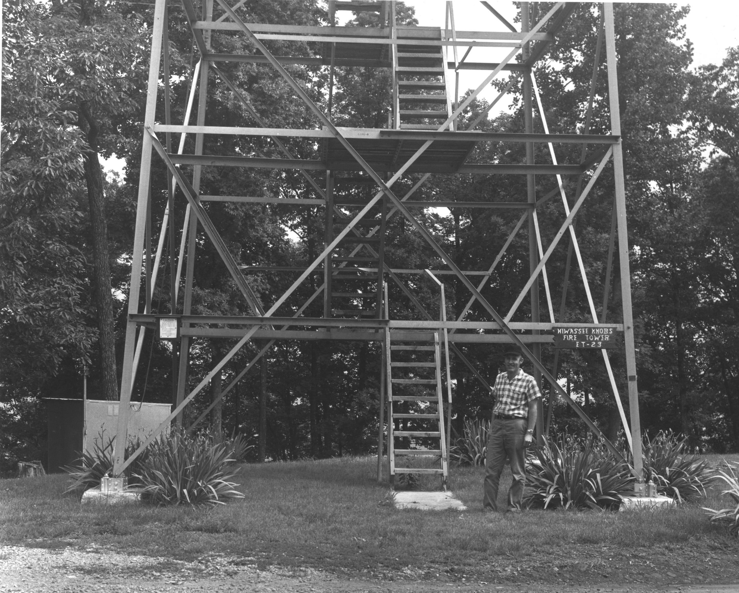
1964 photo
and NHLR
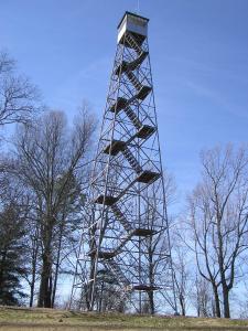
Hiwassee Knobs Fire Tower.
Current
weather at the tower
Tennessee lookout towers

BSF landforms (TN/KY)
GSMNP landforms (TN/NC)
Tennessee landforms
home
arches
waterfalls
rocks
peaks
balds
sinks
lakes
regions
county
 ©
Tom Dunigan
©
Tom Dunigan