Tennessee lookout towers | WGS84 |
| 36.1499 | -84.7282 |
| 36° 8.994'N | 84° 43.692'W |
| 36° 8' 59.6"N | 84° 43' 41.5"W |
| 16S 704380E 4002966N |
| convert to NAD27 |
Windswept
Waypoint: MGT008 36.1499,-84.7282
County: Morgan
Elevation: 1506'
Info: standing
popup list of
nearby towers (mileage, bearing)
or
nearby landforms
MAPS
Select one of the following maps to display this waypoint (WGS84).
GPS
Remarks:
NHLR
tower moved from Walden Ridge
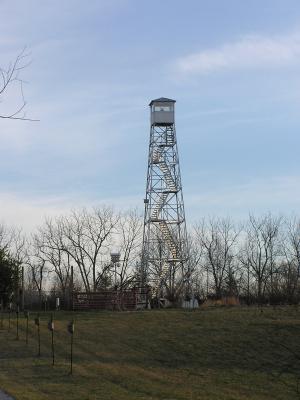
see NHLR
windswept info
and some old and new
photos
Tennessee lookout towers

BSF landforms (TN/KY)
GSMNP landforms (TN/NC)
Tennessee landforms
home
arches
waterfalls
rocks
peaks
balds
sinks
lakes
regions
county
 ©
Tom Dunigan
©
Tom Dunigan