Distance: 8 miles roundtrip
Difficulty: moderate to strenuous
Maps:
(trailhead)
maps
or
Google directions
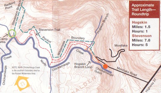
The trails in this 1100-acre wilderness follow North Chickamauga Creek along its north side. Also see the North Chickamauga Creek Gorge. (Note the map above from the brochure is a little misleading, the overlay does not match up with the background contour map.) The trail systems are now part of the Cumberland Trail.
Waterfalls: Power Line Falls Clear Branch Falls Stripmine Falls
More info available at TN natural area. Cumberland Trail North Chickamauga segment and a GPS track.