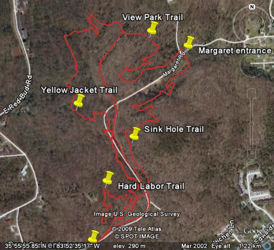
Three miles of bike trails have been developed for the new 75-acre Knoxville Hastie Park. The IMBA trail crew visited May 23-24, 2008 and worked with AMBC/SORBA and volunteers. An old road bed runs 0.76 miles between Margaret Rd and Post Oak Lane. See image below for trails developed to date (3/10/09). In 2012 trails were built that connect Hastie with Ijams via the Georgia Marble Quarry, see Urban Wilerness South Loop map.
See google trail map (5/30/08), park at Margaret Road entrance off of Sevierville Pike. Randy's GPS track and 16 miles of Dirty South GPS track.