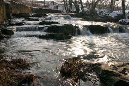
photo courtesy Bill Stowell
| WGS84 | |
| 36.368900 | -82.305000 |
| 36° 22.134'N | 82° 18.3'W |
| 36° 22' 8"N | 82° 18' 18"W |
| 17S 382931E 4025657N | |
| Location uncertain. | |
| convert to NAD27 | |
MAPS
Select one of the following maps to display this waypoint (WGS84).
GPS
Remarks:
Reference: Bill & Craig
The mill is at 3191 Watauga Rd. Johnson City
photo courtesy Bill Stowell
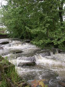 Photo by Gregory Plumb, Author of
Waterfalls of Tennessee
Photo by Gregory Plumb, Author of
Waterfalls of Tennessee