Tennessee Landforms -- waterfalls| WGS84 |
| 36.100800 | -82.591800 |
| 36° 6.048'N | 82° 35.508'W |
| 36° 6' 2.9"N | 82° 35' 30.5"W |
| 17S 356712E 3996302N |
| convert to NAD27 |
Painter Creek Falls 200'
Waypoint: WSF003 36.100800,-82.591800
County: Washington landforms of Washington county
Locale: Cherokee National Forest
popup list of
nearby landforms (mileage, bearing)
MAPS
Select one of the following maps to display this waypoint (WGS84).
GPS
Remarks:
off-trail.
See Bill's photos
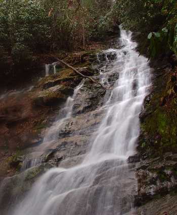 photo courtesy of Marty Silver
Tennessee landforms
home
arches
waterfalls
rocks
peaks
balds
sinks
lakes
regions
county
GSMNP landforms (TN/NC)
BSF landforms (TN/KY)
or nearby
lookout towers
 ©
Tom Dunigan
©
Tom Dunigan