Tennessee Landforms -- waterfalls| WGS84 |
| 35.980780 | -85.424000 |
| 35° 58.847'N | 85° 25.44'W |
| 35° 58' 50.8"N | 85° 25' 26.4"W |
| 16S 642081E 3982965N |
| convert to NAD27 |
Peters Falls 21'
Waypoint: WHF029 35.980780,-85.424000
County: White landforms of White county
popup list of
nearby landforms (mileage, bearing)
MAPS
Select one of the following maps to display this waypoint (WGS84).
GPS
Remarks:
Reference: Chuck Sutherland and his
video
Chris Oliver's
photo
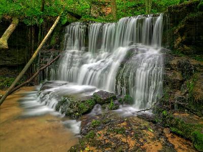 Chris Oliver
Tennessee landforms
home
arches
waterfalls
rocks
peaks
balds
sinks
lakes
regions
county
GSMNP landforms (TN/NC)
BSF landforms (TN/KY)
or nearby
lookout towers
 ©
Tom Dunigan
©
Tom Dunigan