Tennessee Landforms -- waterfalls| WGS84 |
| 35.861700 | -85.255500 |
| 35° 51.702'N | 85° 15.33'W |
| 35° 51' 42.1"N | 85° 15' 19.8"W |
| 16S 657509E 3970014N |
| convert to NAD27 |
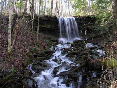
Bee Branch Falls 20'
Waypoint: WHF001 35.861700,-85.255500
County: White landforms of White county
Locale: ScottsGulf
popup list of
nearby landforms (mileage, bearing)
MAPS
Select one of the following maps to display this waypoint (WGS84).
GPS
Remarks:
A sign points to this
wet-weather falls, not really on Bee Branch.
trail
narrative
Tennessee landforms
home
arches
waterfalls
rocks
peaks
balds
sinks
lakes
regions
county
GSMNP landforms (TN/NC)
BSF landforms (TN/KY)
or nearby
lookout towers
 ©
Tom Dunigan
©
Tom Dunigan