Tennessee Landforms -- waterfalls| WGS84 |
| 35.790240 | -85.658240 |
| 35° 47.414'N | 85° 39.494'W |
| 35° 47' 24.8"N | 85° 39' 29.6"W |
| 16S 621253E 3961514N |
| convert to NAD27 |
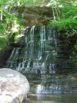
Flat Shoals Falls 18'
Waypoint: WAF009 35.790240,-85.658240
County: Warren landforms of Warren county
Locale: Collins
popup list of
nearby landforms (mileage, bearing)
MAPS
Select one of the following maps to display this waypoint (WGS84).
GPS
Remarks:
Tennessee landforms
home
arches
waterfalls
rocks
peaks
balds
sinks
lakes
regions
county
GSMNP landforms (TN/NC)
BSF landforms (TN/KY)
or nearby
lookout towers
 ©
Tom Dunigan
©
Tom Dunigan