Tennessee Landforms -- waterfalls| WGS84 |
| 35.803900 | -85.626700 |
| 35° 48.234'N | 85° 37.602'W |
| 35° 48' 14"N | 85° 37' 36.1"W |
| 16S 624082E 3963068N |
| convert to NAD27 |
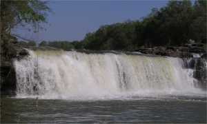
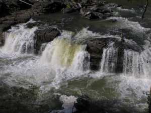
Great Falls 20'
Waypoint: WAF003 35.803900,-85.626700
County: Warren landforms of Warren county
Locale: state park
popup list of
nearby landforms (mileage, bearing)
MAPS
Select one of the following maps to display this waypoint (WGS84).
GPS
Remarks:
Tennessee landforms
home
arches
waterfalls
rocks
peaks
balds
sinks
lakes
regions
county
GSMNP landforms (TN/NC)
BSF landforms (TN/KY)
or nearby
lookout towers
 ©
Tom Dunigan
©
Tom Dunigan