Tennessee Landforms -- waterfalls| WGS84 |
| 35.680691 | -85.380090 |
| 35° 40.841'N | 85° 22.805'W |
| 35° 40' 50.5"N | 85° 22' 48.3"W |
| 16S 646591E 3949742N |
| convert to NAD27 |
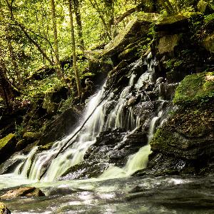
Daisy Cascade 60'
Waypoint: VBF019 35.680691,-85.380090
County: VanBuren landforms of VanBuren county
Locale: state park
popup list of
nearby landforms (mileage, bearing)
MAPS
Select one of the following maps to display this waypoint (WGS84).
GPS
Remarks:
Reference and photos: Thomas Mabry
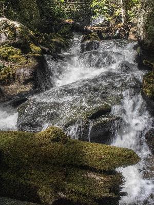
 feeder falls just downstream
Tennessee landforms
home
arches
waterfalls
rocks
peaks
balds
sinks
lakes
regions
county
GSMNP landforms (TN/NC)
BSF landforms (TN/KY)
or nearby
lookout towers
 ©
Tom Dunigan
©
Tom Dunigan