Tennessee Landforms -- arches and natural bridges| WGS84 |
| 35.661900 | -85.346100 |
| 35° 39.714'N | 85° 20.766'W |
| 35° 39' 42.8"N | 85° 20' 46"W |
| 16S 649702E 3947709N |
| convert to NAD27 |
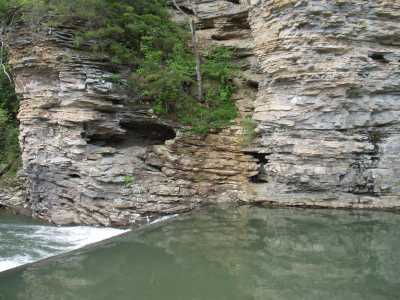
Fall Creek Arch 8x3
Waypoint: VBA001 35.661900,-85.346100
County: VanBuren landforms of VanBuren county
Locale: state park
NABSQNO 16S-649702-3947709
popup list of
nearby landforms (mileage, bearing)
MAPS
Select one of the following maps to display this waypoint (WGS84).
GPS
Remarks:
References: JNAD:TENN-29, John Burns
Tennessee landforms
home
arches
waterfalls
rocks
peaks
balds
sinks
lakes
regions
county
GSMNP landforms (TN/NC)
BSF landforms (TN/KY)
or nearby
lookout towers
 ©
Tom Dunigan
©
Tom Dunigan