Tennessee Landforms -- waterfalls| WGS84 |
| 36.279200 | -83.914650 |
| 36° 16.752'N | 83° 54.879'W |
| 36° 16' 45.1"N | 83° 54' 52.7"W |
| 17S 238204E 4018859N |
| convert to NAD27 |
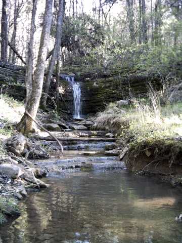
Sharps Station Falls 12'
Waypoint: UNF002 36.279200,-83.914650
County: Union landforms of Union county
Locale: Big Ridge
popup list of
nearby landforms (mileage, bearing)
MAPS
Select one of the following maps to display this waypoint (WGS84).
GPS
Remarks:
Reference & photo: K Baker
wet-weather falls just off Indian Rock Lake trail not far
from Sharp Station historical marker
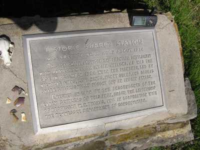 marker
Tennessee landforms
home
arches
waterfalls
rocks
peaks
balds
sinks
lakes
regions
county
GSMNP landforms (TN/NC)
BSF landforms (TN/KY)
or nearby
lookout towers
 ©
Tom Dunigan
©
Tom Dunigan