Tennessee Landforms -- waterfalls| WGS84 |
| 36.088890 | -82.538910 |
| 36° 5.333'N | 82° 32.335'W |
| 36° 5' 20"N | 82° 32' 20.1"W |
| 17S 361452E 3994904N |
| convert to NAD27 |
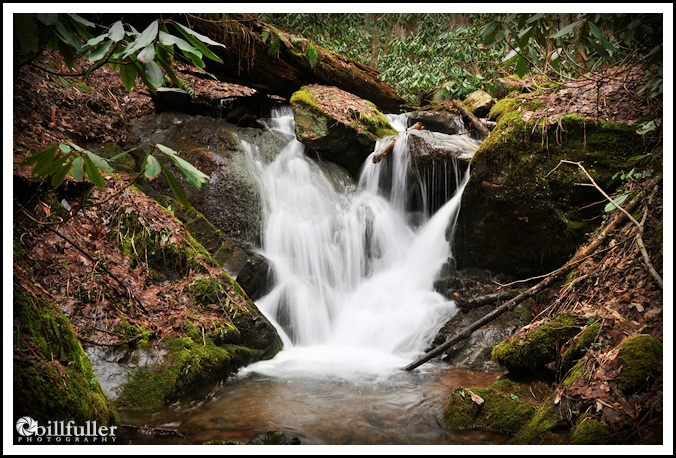
Burchfield Camp Falls 12'
Waypoint: UCF037 36.088890,-82.538910
County: Unicoi landforms of Unicoi county
Locale: Cherokee National Forest
popup list of
nearby landforms (mileage, bearing)
MAPS
Select one of the following maps to display this waypoint (WGS84).
GPS
Remarks:
Reference: Bill Fuller and his
photo of the falls
Within Rocky Fork tract
and a GPS track
Tennessee landforms
home
arches
waterfalls
rocks
peaks
balds
sinks
lakes
regions
county
GSMNP landforms (TN/NC)
BSF landforms (TN/KY)
or nearby
lookout towers
 ©
Tom Dunigan
©
Tom Dunigan