 Photo by Gregory Plumb, Author of
Waterfalls of Tennessee
Photo by Gregory Plumb, Author of
Waterfalls of Tennessee
| WGS84 | |
| 36.055700 | -82.531000 |
| 36° 3.342'N | 82° 31.86'W |
| 36° 3' 20.5"N | 82° 31' 51.6"W |
| 17S 362107E 3991211N | |
| convert to NAD27 | |
MAPS
Select one of the following maps to display this waypoint (WGS84).
GPS
Remarks:
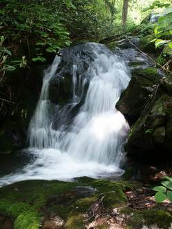
Reference: Bill Stowell
Waypoint is for lower falls(10'), the upper falls (15') is a few hundred
yards up the road (
36.05604 -82.53989)
See Bill's
photos
Photo by Gregory Plumb, Author of
Waterfalls of Tennessee