Tennessee Landforms -- waterfalls| WGS84 |
| 36.148600 | -82.451600 |
| 36° 8.916'N | 82° 27.096'W |
| 36° 8' 55"N | 82° 27' 5.8"W |
| 17S 369412E 4001406N |
| convert to NAD27 |
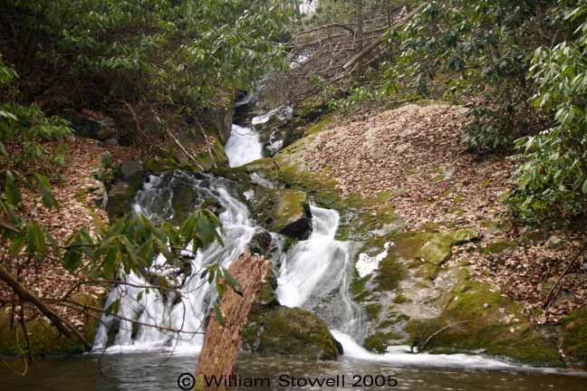
Cody Falls 40'
Waypoint: UCF023 36.148600,-82.451600
County: Unicoi landforms of Unicoi county
Locale: Cherokee National Forest
popup list of
nearby landforms (mileage, bearing)
MAPS
Select one of the following maps to display this waypoint (WGS84).
GPS
Remarks:
off-trail.
A couple of more falls on California Creek
Lower Falls and
Upper Falls
Coordinates & photo courtesy of Bill & Craig.
Tennessee landforms
home
arches
waterfalls
rocks
peaks
balds
sinks
lakes
regions
county
GSMNP landforms (TN/NC)
BSF landforms (TN/KY)
or nearby
lookout towers
 ©
Tom Dunigan
©
Tom Dunigan