Tennessee Landforms -- waterfalls| WGS84 |
| 36.120200 | -82.537300 |
| 36° 7.212'N | 82° 32.238'W |
| 36° 7' 12.7"N | 82° 32' 14.3"W |
| 17S 361652E 3998375N |
| convert to NAD27 |
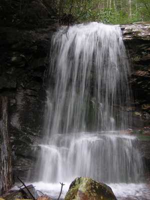
Pine Ridge Falls 25'
Waypoint: UCF015 36.120200,-82.537300
County: Unicoi landforms of Unicoi county
Locale: Cherokee National Forest
popup list of
nearby landforms (mileage, bearing)
MAPS
Select one of the following maps to display this waypoint (WGS84).
GPS
Remarks:
Reference: Bill & Craig
Tennessee landforms
home
arches
waterfalls
rocks
peaks
balds
sinks
lakes
regions
county
GSMNP landforms (TN/NC)
BSF landforms (TN/KY)
or nearby
lookout towers
 ©
Tom Dunigan
©
Tom Dunigan