| WGS84 | |
| 35.581400 | -83.483800 |
| 35° 34.884'N | 83° 29.028'W |
| 35° 34' 53"N | 83° 29' 1.7"W |
| 17S 274941E 3940361N | |
| convert to NAD27 | |
MAPS
Select one of the following maps to display this waypoint (WGS84).
GPS
Remarks:
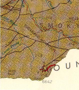
One of two igneous formations in TN, neither are visually significant. The red indicates the location of igneous rock near Clingman's Dome, off-trail. More outcroppings can be seen on the 155 MB pdf referenced here.
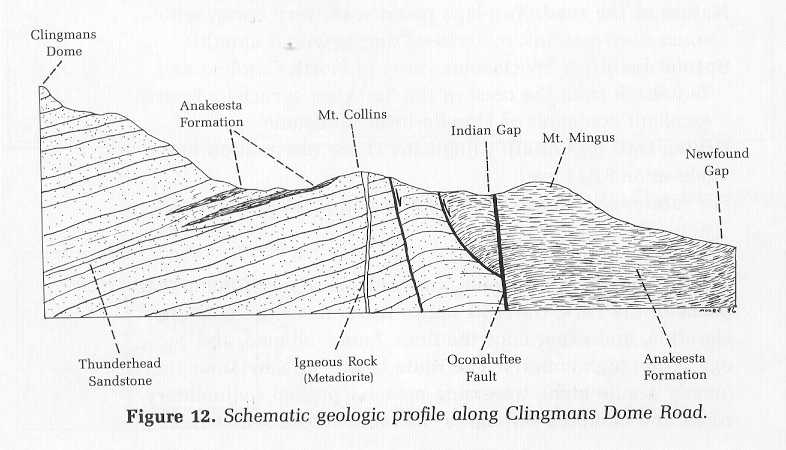 (from Roadside Guide by Moore)