Tennessee Landforms -- waterfalls| WGS84 |
| 35.659900 | -83.659300 |
| 35° 39.594'N | 83° 39.558'W |
| 35° 39' 35.6"N | 83° 39' 33.5"W |
| 17S 259271E 3949486N |
| convert to NAD27 |
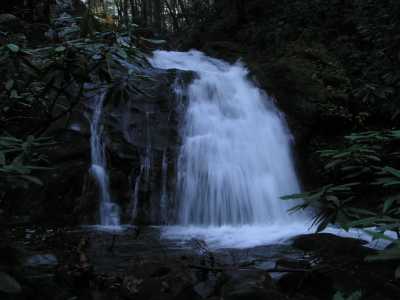
Meigs Creek Cascade 18'
Waypoint: SVF046 35.659900,-83.659300
County: Sevier landforms of Sevier county
Locale: Great Smoky Mountains National Park
popup list of
nearby landforms (mileage, bearing)
MAPS
Select one of the following maps to display this waypoint (WGS84).
GPS
Remarks:
along Meigs Creek trail
Tennessee landforms
home
arches
waterfalls
rocks
peaks
balds
sinks
lakes
regions
county
GSMNP landforms (TN/NC)
BSF landforms (TN/KY)
or nearby
lookout towers
 ©
Tom Dunigan
©
Tom Dunigan