Tennessee Landforms -- waterfalls| WGS84 |
| 35.660800 | -83.606400 |
| 35° 39.648'N | 83° 36.384'W |
| 35° 39' 38.9"N | 83° 36' 23"W |
| 17S 264063E 3949457N |
| convert to NAD27 |
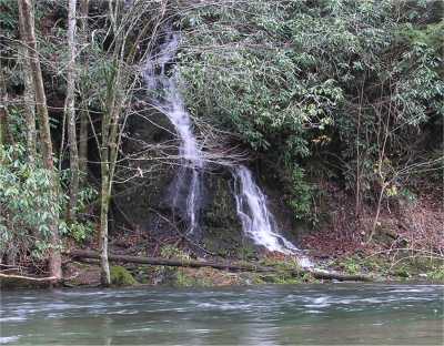
Little River Feeder 15'
Waypoint: SVF040 35.660800,-83.606400
County: Sevier landforms of Sevier county
Locale: Great Smoky Mountains National Park
popup list of
nearby landforms (mileage, bearing)
MAPS
Select one of the following maps to display this waypoint (WGS84).
GPS
Remarks:
wet-weather feeder cascade into Little River
Tennessee landforms
home
arches
waterfalls
rocks
peaks
balds
sinks
lakes
regions
county
GSMNP landforms (TN/NC)
BSF landforms (TN/KY)
or nearby
lookout towers
 ©
Tom Dunigan
©
Tom Dunigan