Tennessee Landforms -- waterfalls| WGS84 |
| 35.695850 | -83.353300 |
| 35° 41.751'N | 83° 21.198'W |
| 35° 41' 45.1"N | 83° 21' 11.9"W |
| 17S 287072E 3952767N |
| convert to NAD27 |
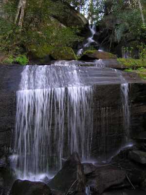
Little Laurel Br. Cascade 35'
Waypoint: SVF024 35.695850,-83.353300
County: Sevier landforms of Sevier county
Locale: Great Smoky Mountains National Park
popup list of
nearby landforms (mileage, bearing)
MAPS
Select one of the following maps to display this waypoint (WGS84).
GPS
Remarks:
off-trail. nice hanging valley above the cascade.
Tennessee landforms
home
arches
waterfalls
rocks
peaks
balds
sinks
lakes
regions
county
GSMNP landforms (TN/NC)
BSF landforms (TN/KY)
or nearby
lookout towers
 ©
Tom Dunigan
©
Tom Dunigan