Tennessee Landforms -- waterfalls| WGS84 |
| 35.608200 | -83.466810 |
| 35° 36.492'N | 83° 28.009'W |
| 35° 36' 29.5"N | 83° 28' 0.5"W |
| 17S 276555E 3943295N |
| convert to NAD27 |
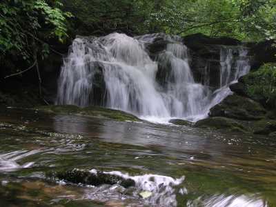
Tomahawk Prong Falls 15'
Waypoint: SVF021 35.608200,-83.466810
County: Sevier landforms of Sevier county
Locale: Great Smoky Mountains National Park
popup list of
nearby landforms (mileage, bearing)
MAPS
Select one of the following maps to display this waypoint (WGS84).
GPS
Remarks:
off-trail wade.
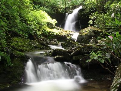 Upper Falls 28' at
35.607362,-83.466337 courtesy fo David Sands and Mike Gourley
Upper Falls 28' at
35.607362,-83.466337 courtesy fo David Sands and Mike Gourley
hiking Tomahawk Prong
Tennessee landforms
home
arches
waterfalls
rocks
peaks
balds
sinks
lakes
regions
county
GSMNP landforms (TN/NC)
BSF landforms (TN/KY)
or nearby
lookout towers
 ©
Tom Dunigan
©
Tom Dunigan