Tennessee Landforms -- waterfalls| WGS84 |
| 35.676500 | -83.396600 |
| 35° 40.59'N | 83° 23.796'W |
| 35° 40' 35.4"N | 83° 23' 47.8"W |
| 17S 283101E 3950715N |
| convert to NAD27 |
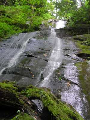
Fern Branch Falls 60'
Waypoint: SVF003 35.676500,-83.396600
County: Sevier landforms of Sevier county
Locale: Great Smoky Mountains National Park
popup list of
nearby landforms (mileage, bearing)
MAPS
Select one of the following maps to display this waypoint (WGS84).
GPS
Remarks:
Tennessee landforms
home
arches
waterfalls
rocks
peaks
balds
sinks
lakes
regions
county
GSMNP landforms (TN/NC)
BSF landforms (TN/KY)
or nearby
lookout towers
 ©
Tom Dunigan
©
Tom Dunigan