Tennessee Landforms -- arches and natural bridges| WGS84 |
| 35.636600 | -83.437920 |
| 35° 38.196'N | 83° 26.275'W |
| 35° 38' 11.8"N | 83° 26' 16.5"W |
| 17S 279251E 3946381N |
| convert to NAD27 |
Arch Rock 6x12
Waypoint: SVA001 35.636600,-83.437920
County: Sevier landforms of Sevier county
Locale: Great Smoky Mountains National Park
NABSQNO 17S-279251-3946381
popup list of
nearby landforms (mileage, bearing)
MAPS
Select one of the following maps to display this waypoint (WGS84).
GPS
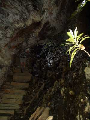
Remarks:
The Alum Cave trail passes through this natural bridge.
Dutch Roth's
photograph
January, 1936
Tennessee landforms
home
arches
waterfalls
rocks
peaks
balds
sinks
lakes
regions
county
GSMNP landforms (TN/NC)
BSF landforms (TN/KY)
or nearby
lookout towers
 ©
Tom Dunigan
©
Tom Dunigan