Tennessee Landforms -- arches and natural bridges| WGS84 |
| 35.351950 | -85.319100 |
| 35° 21.117'N | 85° 19.146'W |
| 35° 21' 7"N | 85° 19' 8.8"W |
| 16S 652733E 3913371N |
| convert to NAD27 |
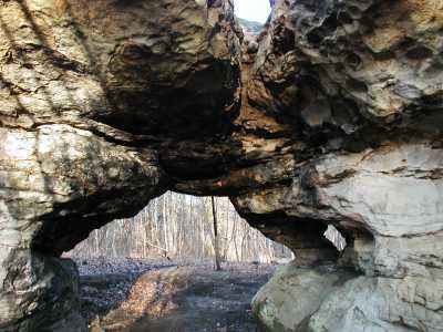
Window Rock 6x6
Waypoint: SQA001 35.351950,-85.319100
County: Sequatchie landforms of Sequatchie county
NABSQNO 16S-652733-3913371
popup list of
nearby landforms (mileage, bearing)
MAPS
Select one of the following maps to display this waypoint (WGS84).
GPS
Remarks:
References: JNAD:TENN-74,Todd Fife
Tennessee landforms
home
arches
waterfalls
rocks
peaks
balds
sinks
lakes
regions
county
GSMNP landforms (TN/NC)
BSF landforms (TN/KY)
or nearby
lookout towers
 ©
Tom Dunigan
©
Tom Dunigan